| You are herei: Home Today is: 30-04-2024 | sei il visitatore numero: 4219 | |
 |
| You are herei: Home Today is: 30-04-2024 | sei il visitatore numero: 4219 | |
|

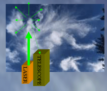
LIDAR(LIght Detection And Ranging)is an optical remote sensing technology that measures properties of scattered light to find range and/or other information of a distant target. The prevalent method to determine distance to an object or surface is to use laser pulses. Like the similar radar technology, which uses radio waves instead of light, the range to an object is determined by measuring the time delay between transmission of a pulse and detection of the reflected signal. LIDAR technology has application in archaeology, geography, geology, geomorphology, seismology, remote sensing, atmospheric physics[1] and laser altimetry[3]. In these pages you'll find our applications in the field of cloud and aerosol physics. Many tutorials about LIDARs are available on the web. We selected the followings: -LIDAR tutorial in AbsoluteAstronomy.com -P.S. Argall and R.J. Sica, Lidar (Laser Radar) in The Optics Encyclopedia: Basic Foundations And Practical Applications, Vol 2, Ed. T. G. Brown et al., (ISBN 3-527-40320-5) Wiley-VCH Verlag GmbH &, 1305-1322, 2004. -An extensive LIDAR Bibliography -A basic reference about the Depolarization Technique
|
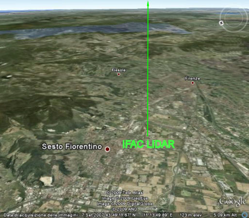
Massimo Del Guasta - National Institute of Optics (INO) - National Research Council | Via Madonna del Piano, 10 - 50019 Sesto Fiorentino - Firenze, Italy | Tel (office): +39-055-5226423 - Tel (laboratory) +39-055-5226424 | Email: Massimo Del Guasta | Web: www.ino.it | sito ottimizzato per una risoluzione minima di 1024x768 e firefox
 BioOptics